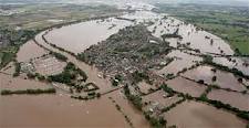
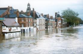
 New flood risk maps have been produced by the Environment Agency that, for the first time, also include areas at risk of flooding from surface water in addition to the risk from rivers and the sea. According to The Independent, new mapping techniques used by the EA have reduced the number of homes shown at risk of surface water flooding – when the drainage system cannot cope with extreme heavy rainfall – by 800,000 to 3 million with a further 2.4 million properties are at risk of flooding from rivers and/or the sea.
The new EA flood risk maps will give insurance companies more information to set premiums and could alter the risk profile of homes now shown as at risk of flooding, with some homeowners seeing their premiums increase.
For homeowners that search for the best deals using comparison websites, the average annual premium is £130 according to the AA. However, those that live in areas deemed at risk of flooding pay huge premiums and have excesses that can be thousands of pounds, with insurance companies setting premiums to fully reflect the risk of flooding.
 In the past, homeowners in high-risk areas have been subsidised to some extent by those living in regions with a low risk of flooding. However, this has now become unsustainable, with the increasing frequency, number and cost of claims arising from damage caused by flooding since 2007. Some policyholder’s premiums have risen substantially, by as much as 35%, after a revised flood risk assessment by their insurers. Many homes that had been flooded in the past have become virtually uninsurable.